Drone Technology
Intelligent agriculture
Advantages of mapping and spraying drones

Using drones, it is possible to quickly and cost-effectively map, inspect, analyse and spray almost any area. Moreover, thanks to the automated processes, the work will be much more precise.

Increased efficiency
You can increase the efficiency of geographic information collection and simplify data processing with the help of drone solutions.

Reduced costs
With drones and their auxiliary software, we can carry out automated data collection in a cost-effective manner with a minimal investment of effort.

Accurate results
The collected data is accurate to centimeter and geographically fixed. All recordings can be analyzed and processed in the requested form by the client.

Targeted work
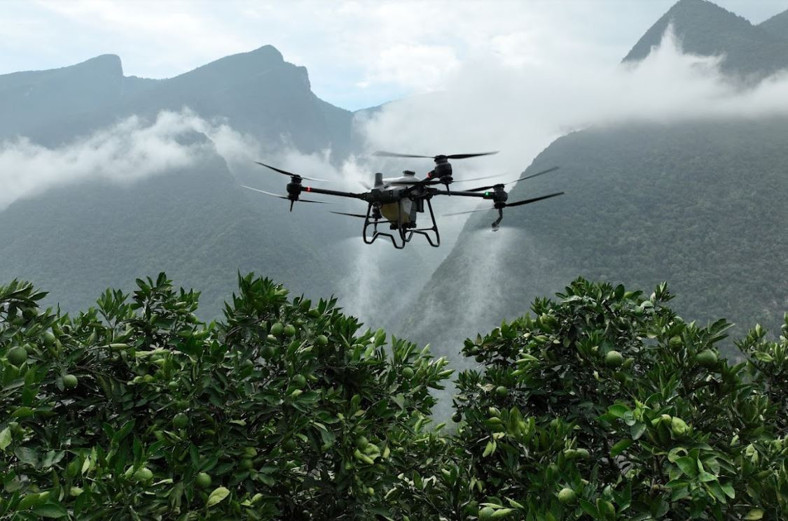
During spraying, it can deliver the spray to the plants in a width of up to 8 meters without any damage.

Harmless performance
The drone does not harm the plants or the soil while performing its tasks.

Quality indicators
Better coverage is achieved thanks to the smaller droplet size. The droplet sprayed into the downward moving air mass quickly reaches the target surface.

Terrain evaluation
Whether it is cadastral, topographic, area coverage or land use measurements, the possibilities provided by drones provide truly spectacular, rewarding and standardized solutions.
The high-resolution images taken by drones in flight are tagged with accurate geographical tags, which can be used to create models that correspond to reality to the nearest centimeter. This does not require long working hours or a large team, since the drones can be controlled by one person using a single remote control. In this way, even areas that are difficult or dangerous to reach can be glimpsed in real time.
The high-resolution images taken by drones in flight are tagged with accurate geographical tags, which can be used to create models that correspond to reality to the nearest centimeter. This does not require long working hours or a large team, since the drones can be controlled by one person using a single remote control. In this way, even areas that are difficult or dangerous to reach can be glimpsed in real time.


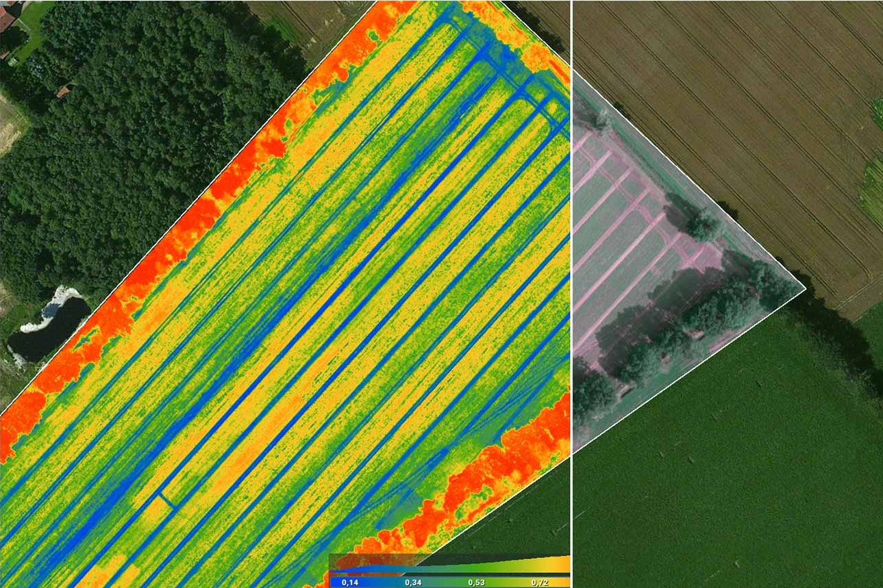
Plant analysis
With drones, we have the opportunity to continuously monitor the development of the health of the entire biomass and can even use them to prepare plant vegetation analysis (NVDI).
We can detect pests with them, or discover diseases in a timely, treatable stage. In addition to the supply of nutrients, it can also reveal a lack of water or an excess of it. With the help of the collected data, we can create the optimal condition for our plants, estimate yields, monitor the ripening process, and perfect spraying and watering.
We can detect pests with them, or discover diseases in a timely, treatable stage. In addition to the supply of nutrients, it can also reveal a lack of water or an excess of it. With the help of the collected data, we can create the optimal condition for our plants, estimate yields, monitor the ripening process, and perfect spraying and watering.

Damage assessment
In the case of a traditional damage assessment, it can be a serious difficulty to determine the damage of tall buildings, hard-to-reach places and large areas.
By using drone technology, the damage assessment becomes significantly simplier in such cases. The high-resolution images taken from above can help us with damage and claim settlement, risk assessment, and information gathering regarding the given damage event. In an area-based damage assessment, we receive completely accurate information about the size of the affected area based on the GPS coordinates.
By using drone technology, the damage assessment becomes significantly simplier in such cases. The high-resolution images taken from above can help us with damage and claim settlement, risk assessment, and information gathering regarding the given damage event. In an area-based damage assessment, we receive completely accurate information about the size of the affected area based on the GPS coordinates.


Spraying
During spraying with drone technology, we may need 90% less water and 50% less pesticides than in the case of previous spraying technologies.
It is possible to fully spray flooded, waterlogged, soggy areas.
Spot treatment is solved, so you can create more effective and environmentally friendly plant protection on your farm.
You have the opportunity to spray even in extreme terrain conditions.
Due to the low water requirement (up to 10 l/ha on arable land), it can spray divided land areas more efficiently.